
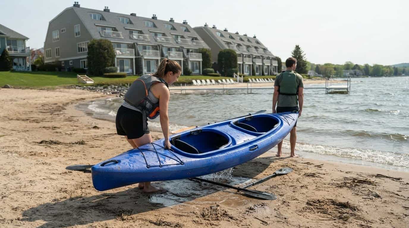
The shortest crossing of Mullett Lake is 10 miles, making open-water conditions an important part of exploring Michigan’s Inland Waterway. The route winds through lakes and rivers from north of Petoskey to Lake Huron, while a coastal route continues from Cheboygan toward Mackinaw City and the Straits of Mackinac.
Michigan’s Inland Waterway offers a serene way to explore northern Michigan, but its stretches aren’t all alike. Motorboat traffic can be heavy on the Crooked and Indian Rivers in peak summer, while storms and heavy seas can make paddling Burt and Mullett Lakes dangerous.
This guide outlines the route and its connection to the Straits, explains bridge clearances and lock locations, and highlights access sites, campgrounds, and paddling resources. It also covers conditions that can shape a trip on Mullett Lake and the wider waterway, helping you understand which stretches suit your plans and where extra care is needed.
Key Takeaways
- Follow the lake-and-river chain and locate the two locks to understand how the inland route connects toward Lake Huron.
- Use the lowest fixed bridge clearance, 14.7 feet at the M-27 bridge, as a key planning detail for boat passage.
- Find access and camping options along the waterway, including four state campgrounds and nearby trail connections for paddle-and-bike outings.
- Learn why Black Lake isn’t reachable by boat from the waterway and how river traffic and changing lake conditions can shape a trip.
Coastal route to Mackinaw City and the Straits of Mackinac
Michigan’s Inland Waterway links northern lakes and rivers with Lake Huron, while a coastal route continues toward Mackinaw City and the Straits. Together, these routes offer distinct ways to explore Cheboygan and the surrounding shoreline.
Coastal and Inland Route Connections
The coastal route from Cheboygan to Mackinaw City and the Straits of Mackinac forms part of the Huron Shores Blueways. It extends a trip beyond the inland chain, but it is a separate coastal connection, not a passage to Lake Michigan. Little Traverse Bay lies 2 miles west of Crooked Lake, yet the Inland Waterway does not connect to the bay. In the Straits, winds and currents can create difficult conditions, making that stretch suitable for experienced paddlers.
Connected Waterway Communities
The Inland Waterway water trails connect six Michigan communities and seven state parks. The route passes through Emmet and Cheboygan counties, linking communities along a varied chain of lakes and rivers. This makes it possible to plan outings around different launch areas and waterfront settings rather than treating the waterway as one continuous, uniform stretch. Summer traffic on some river sections can affect the pace and feel of a trip.
Route Length and Geography
The historic waterway is 40 miles long, beginning north of Petoskey and reaching Lake Huron through connected inland waters. Its route includes Pickerel Lake, Crooked Lake, Crooked River, Burt Lake, Indian River, Mullett Lake, and the Cheboygan River. The seven-mile Cheboygan River links Mullett Lake with Lake Huron. This geography matters when planning a route: river passages, broad lake crossings, and the final river reach each bring different conditions.
Locks and Operating Rules
Two locks, at Alanson and Cheboygan, serve the Inland Waterway. The locks operate from mid-April to late October; in 2025, Cheboygan River Lock operated May 23 to Oct. 20, with a $6 recreational daily fee or $45 seasonal pass. Crooked River Lock operated April 28 to Oct. 19, 2025, with a $15 daily fee. These are seasonal operating details, not daily opening hours.
Michigan boating requirements cover vessel registration, operator qualifications, and safety equipment; the rules that apply depend on the craft and operator. There is no fixed travel time: distance, boat speed, lock waits, stops, and conditions on the lakes and rivers all affect the schedule.
Bridge clearances
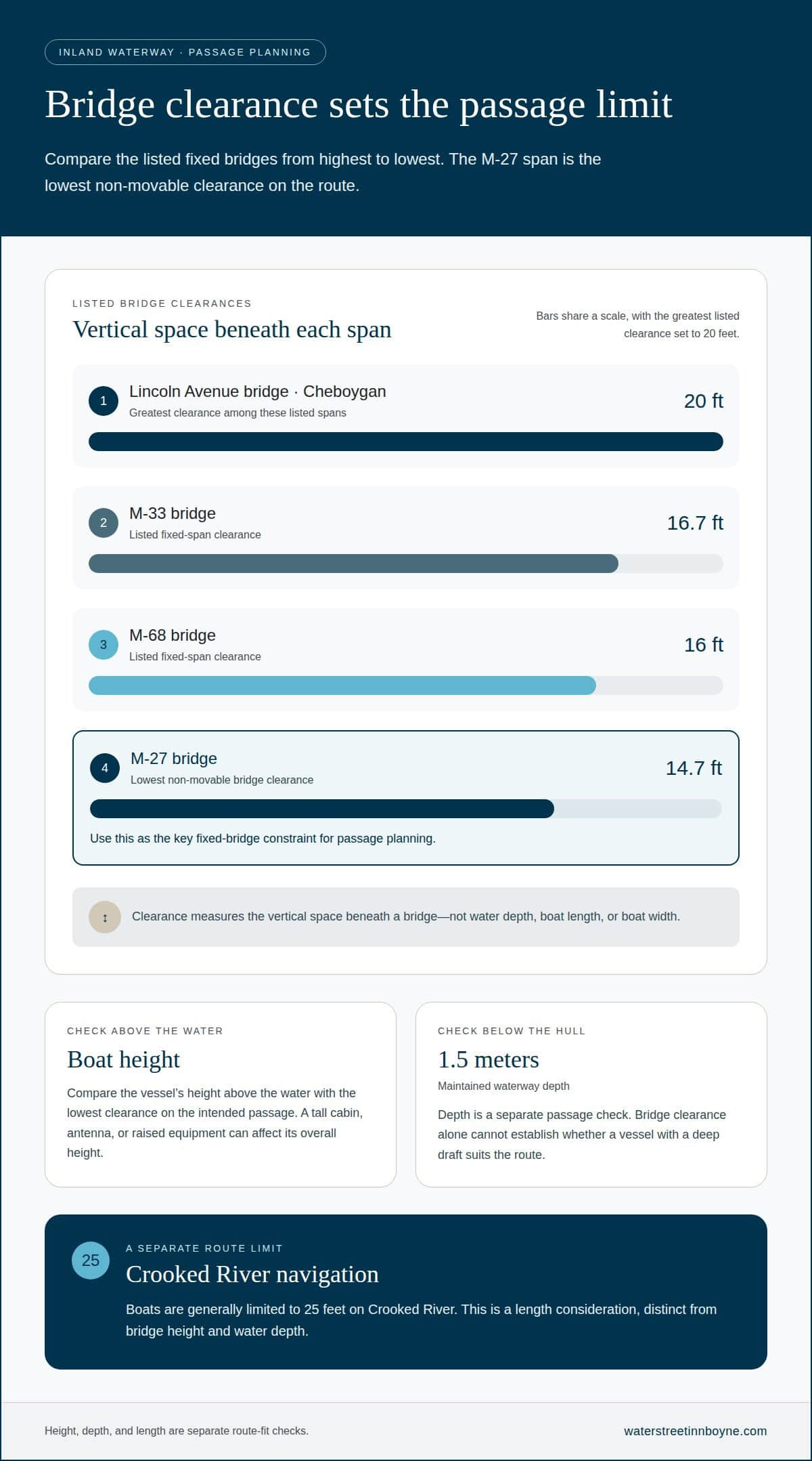
Bridge clearance sets the maximum vertical space available beneath a bridge, so a boat’s height matters along Michigan’s Inland Waterway. The lowest non-movable bridge clearance is 14.7 feet at the M-27 bridge. A vessel that fits beneath taller spans may still be unable to pass this lowest fixed point.
Clearances along the route include several distinct measurements: Lincoln Avenue bridge in Cheboygan has 20 feet; the M-33 bridge has 16.7 feet; the M-68 bridge has 16 feet; and the M-27 bridge has 14.7 feet. The Lincoln Avenue span offers the greatest clearance among these examples, while M-27 sets the limiting figure for passage under non-movable bridges. These figures describe vertical space, not water depth or the boat’s length.
For route planning, compare the boat’s height above the water with the lowest clearance on the intended passage. A tall cabin, antenna, or raised equipment can affect the vessel’s overall height, so the boat’s profile matters as much as its hull. A clearance figure is not a general boat-size limit: length and width are separate considerations, and Crooked River navigation generally limits boats to 25 feet.
Depth also shapes passage. The Inland Waterway is maintained to a depth of 1.5 meters, a separate measurement from the clearance beneath a bridge. A vessel must have room below its hull as well as above its highest point. This distinction is useful when considering a boat with a deep draft: bridge clearance alone cannot establish whether the entire route suits it.
Cheboygan River, Alanson, and Crooked River mark different parts of the route, so a single bridge number does not describe every passage. The M-27 figure is the key fixed-bridge constraint, while the 1.5-meter maintained depth describes the waterway. Treating height and depth as separate checks gives boaters a clearer picture of route fit.
Access sites, campgrounds, and paddling resources
Planning access along the Inland Waterway starts with choosing a stretch, rather than assuming every shoreline has a launch. The route includes Crooked Lake, Burt Lake, Indian River, Mullett Lake, and the Cheboygan River, and access needs differ between rivers and lakes. Four state campgrounds along the waterway offer overnight options. The trail network also connects six communities, giving paddlers a range of places to plan an outing.
For a quieter river paddle in summer, early morning is the best time on Crooked and Indian Rivers. Those channels offer a different experience from open lake crossings, where wind and waves can change the outing. The Inland Waterway water trails connect seven state parks and 20 Little Traverse Conservancy nature preserves. These destinations broaden the options for pairing time on the water with visits to protected natural areas.
Three state trails run alongside sections of the waterway: the North Central State Trail, North Eastern State Trail, and North Western State Trail. Their proximity makes combined paddle-and-bike outings possible. For example, a group can pair a river or lake trip with a trail ride instead of relying on one activity all day. The trails and water routes pass through distinct communities and waterfront settings.
Choose a trip by matching the waterbody to the outing: a river segment such as Indian River for a moving-water paddle, or a lake for broader views and open-water conditions. The shortest Burt Lake crossing is 6.5 miles, while Mullett Lake’s shortest crossing is 10 miles, so both require a different plan from a short river excursion. Four state campgrounds support overnight itineraries, while the seven connected parks and 20 preserves offer additional places to explore near the water.
Challenges affecting Mullett Lake and the Inland Waterway
Summer mornings are a practical time to paddle the Crooked and Indian Rivers. When exploring Michigan’s Inland Waterway, an early start can get you on the water before motorboat traffic builds, especially on busy weekends. No single season suits every stretch: a river paddle and an open-water crossing bring different conditions. Check the forecast before setting out, since wind and storms can change lake conditions.
Peak-summer traffic is a key challenge on the Crooked and Indian Rivers. Motorboats can be especially numerous on weekends and afternoons, so paddlers share narrow waterways with larger, faster craft. An early start can help you avoid the busiest part of the day, but you still need to stay alert. Watch for approaching boats and allow room when passing.
Burt Lake and Mullett Lake bring a different concern: exposure to storms and heavy seas. Paddling either lake in those conditions is very dangerous. Unlike a river route, an open-lake crossing offers less shelter from changing water conditions. A calm departure doesn’t guarantee calm water later, so check the forecast before launching and keep conditions in mind as you plan.
The route has a significant limit near Black Lake: a section of the Black River isn’t navigable, preventing boat access from the Inland Waterway into Black Lake. Don’t assume the connected chain of rivers and lakes forms an uninterrupted boat passage to every nearby lake. The Black River barrier changes the route itself, not just the time or comfort of a trip.
To explore Michigan’s Inland Waterway responsibly, match your outing to the waterbody. Choose a summer morning for paddling the Crooked or Indian River, and treat stormy or rough conditions on Burt and Mullett Lakes as dangerous for paddlers. Check the forecast before departure, account for peak weekend and afternoon traffic, and plan around the non-navigable section of the Black River. Lake Huron and the inland lakes present different exposures, so conditions on one stretch don’t describe the whole waterway.
Water Street Inn
Water Street Inn offers a comfortable place to stay while planning a Northern Michigan getaway that includes time on the water. For a private, home-like base between outings, the One Bedroom Suite features a fully equipped kitchen and a private balcony or patio with Lake Charlevoix views. Located in Boyne City, the inn offers a different setting from the Inland Waterway, making it a fit for a wider regional itinerary.
A private beach and walkable access to downtown Boyne City offer a restful contrast to days spent exploring lakes and rivers. Water Street Inn also offers Wedding Venue Rental for couples planning a celebration. To plan a stay or wedding venue rental, contact Water Street Inn.
Make Space for a Northern Michigan Getaway
Make exploring Michigan’s Inland Waterway more than a day on the water. Shape your itinerary around the experience you want, whether that’s an active outing, an unhurried afternoon by the shore, or a blend of both. A flexible plan leaves room to enjoy the landscape at your own pace and discover what makes Northern Michigan restorative.
For a stay that pairs naturally with time near the water, consider Water Street Inn beside Lake Charlevoix in Boyne City. Whether you’re planning a getaway or a celebration, choose the inn as your home base and contact Water Street Inn to plan your visit.
Contact Water Street Inn to start planning your time in the region, and look forward to a memorable Northern Michigan escape.
Frequently Asked Questions
What is Michigan’s Inland Waterway route and how long is it?
Michigan’s Inland Waterway is a historic, 40-mile chain of connected waters leading to Lake Huron. The route begins north of Petoskey and travels through lakes and rivers toward Cheboygan. Its length describes the inland waterway, not the separate coastal continuation toward Mackinaw City and the Straits of Mackinac. For trip planning, distinguish that inland route from the larger regional network of water trails.
Which towns, lakes, rivers, and canals are connected by the Inland Waterway?
The waterway passes through six communities and is best understood as a chain of connected waters: Pickerel Lake, Crooked Lake, Crooked River, Burt Lake, Indian River, Mullett Lake, and the Cheboygan River. Locks at Alanson and Cheboygan connect sections of the route. The waterway does not reach Little Traverse Bay or provide access to Lake Michigan, so nearby shorelines aren’t automatically part of the same boat passage.
What boat sizes and types can navigate the Inland Waterway?
The waterway’s stated capacity is boats up to 65 feet long, with an 18-foot beam and a 5-foot draft. Lock dimensions are more restrictive: the locks can handle boats up to 60 feet long and 17 feet wide. A boat that fits the overall waterway limits may therefore exceed lock capacity. Motorboats and paddled craft use the route, but vessel dimensions and route conditions determine suitability.
What are the current bridge clearances and water depths along the route?
Clearances vary by bridge: Lincoln Avenue in Cheboygan is 20 feet, M-33 is 16.7 feet, M-68 is 16 feet, and M-27 is 14.7 feet. That M-27 span is the lowest non-movable bridge clearance. The waterway is maintained to a depth of 1.5 meters. Clearance measures overhead space; depth concerns water beneath the hull, so both measurements matter for boat passage.
Where can boaters find fuel, marinas, overnight docking, and supplies?
Four state campgrounds along the waterway offer overnight camping, while parks and connected communities can help shape stopovers. Fuel, marinas, overnight docking, and supplies depend on the individual facility, rather than being available at every access point. Plan your route around services at intended stops and allow for distance between them. Trails along the waterway also connect parks and nature preserves for breaks on shore.
What are the best stops and attractions along Michigan’s Inland Waterway?
For a mix of water and land experiences, consider the connected state parks, Little Traverse Conservancy nature preserves, and trails running parallel to parts of the route. The waterway also carries a long human history: 50 Native American encampments have been discovered along it, and artifacts at Ponshewaing date back over 3,000 years. These places add cultural and natural interest beyond time spent boating.